Day 2: That Sign Can't Be Right
Day 2 was set to be a bear. The first day we walked 10 miles, with only five of them carrying our heavy bags, and were exhausted. The second day was set to be 15 miles with the bags on the whole time. Determined to get an early jump on the day, I set my alarm for 6:30 a.m. I didn’t need it, though, as I couldn’t sleep much anyway. After waking Lionel, we hit our 7:15 departure time within five minutes.
Now, Lionel is a great adventurer with good stamina. He is still, however, eight years old and has limited eyesight, so his walking speed is about 60% that of an adult. In order to get through the day with our bags, Brian and I had to plan accordingly. We decided that we would take turns walking with Lionel for about a mile and a half while the other person could speed ahead and then take a break. While I would classify myself as a patient person, that patience wanes considerably when a heavy bag is digging into my shoulders. This system would allow us to stay a bit more rested since we could walk at our regular pace when we were carrying the bags. For the first stretch, Brian took off, and we decided to meet where we had gathered water the previous day.
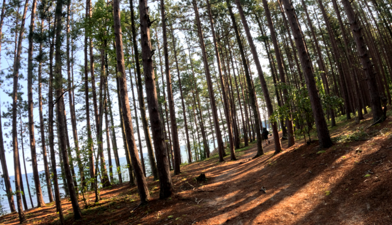
The route to Miner’s Castle was a repeat from yesterday, except this time we had our bags. One major difference was that the day was a clear blue sky, and Lake Superior was visible through the tree line. Lionel walked the full two miles without needing any Sour Patch Kids. Upon arriving, we had a little snack and used the luxurious flush toilets one last time. Brian and I then switched, and I plowed ahead.
The next section of the trail changed considerably. While the trail grew more hilly, there were no longer sections of thick, oozy mud, though there certainly continued to be plenty of rooty sections. While I enjoyed the morning walk with Lionel, the next hour of Minecraft-less silence was actually pretty welcoming. I wasn’t exactly sure how far up ahead I was when I came to a stairwell leading to a beautiful sandy beach. I dropped the heavy backpack and waited for the members of Team Hope in Motion to emerge. After 15 minutes of waiting, I got a bit fretful and began to double back, thinking maybe an injury had occurred. I decided to drop my bag and lightly jog back, but after two minutes I could hear, “And that’s why you use a diamond sword,” and knew that Lionel was simply gabbing Brian’s ear off about the intricacies of Minecraft weaponry.
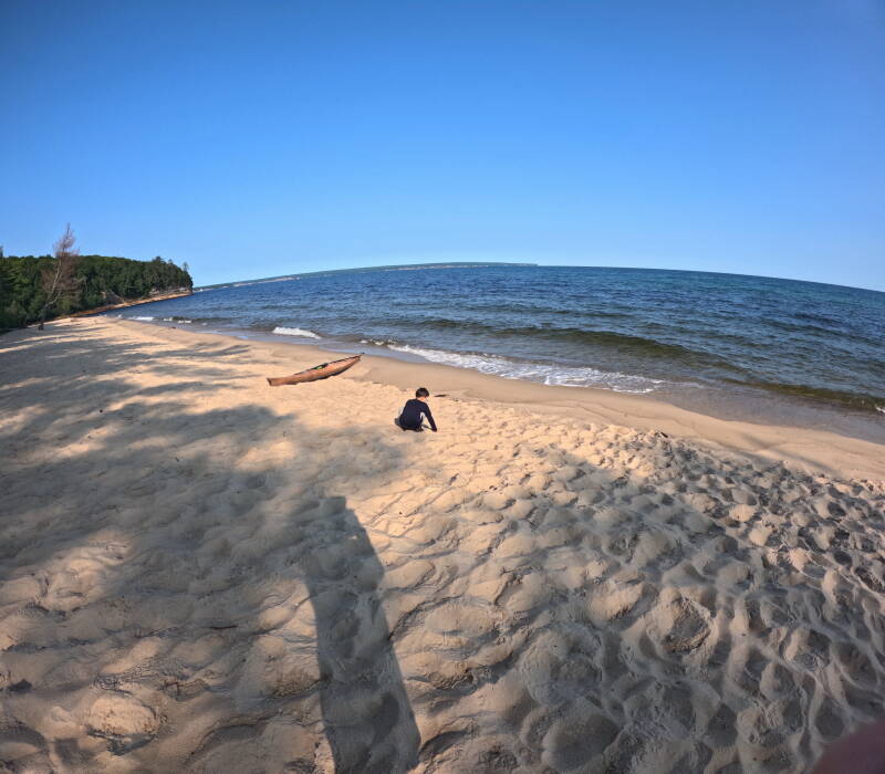
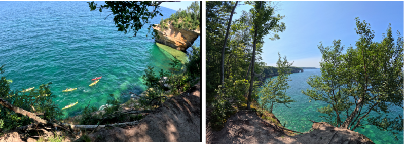
We took a moment to stop at the beach and plant our butts in the sand. As we did, we saw two men with kayaks push off from the shore and paddle into the waves and away. Just several hundred meters down the shore, a tourist group of kayakers was doing the same. I would have loved to have had a little lunch at the beach and basked in the sun, but we were on a tight schedule. Fortunately, everyone was still feeling great, and we were about to hit the most scenically beautiful part of the stretch. Brian and I switched again, but the trail was smooth and rootless, and Lionel and I were able to keep up with Brian’s speed.
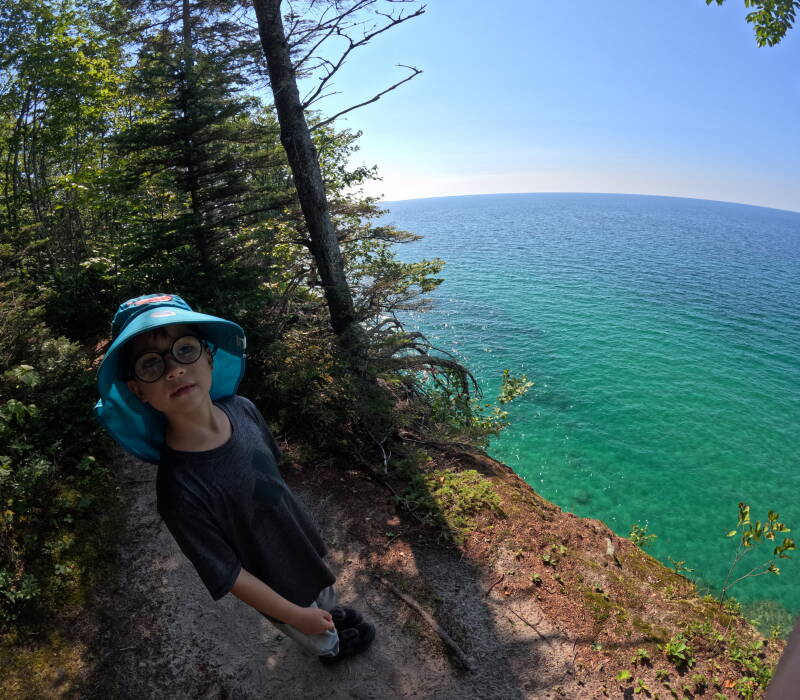
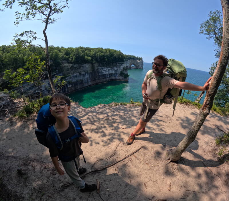
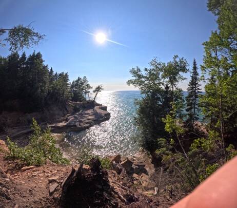
After about 25 more minutes of walking, we had to cross a road and then climb an enormous hill, the kind where you climb for what feels like forever, look up, and still don’t see the top. I decided to employ a little strategy from RAGBRAI where you just look down, see the ground moving under your feet, and tell yourself that you are making progress. I’m not sure exactly how much time it took us to reach the top of the hill, but we were certainly out of breath when we did. According to the sign at the bottom of the hill, we had about 2.2 miles to Mosquito River, a spot we had picked out for lunch. At this point, we were beginning to tire, but the views were absolutely spectacular, and the temperature and sky could not have been more ideal. We weaved around the edge of the bluffs looking out onto Superior. The waters of Superior had that two-tone look that seemed almost tropical.
There were lots of gorgeous overlooks on the trail, but the most famous landmark in the national park was called “Lover’s Leap,” a large stone archway that jutted out into Superior after years of erosion. Lionel, who had learned all about erosion in science class, explained the process perfectly: “Water smacks against the rocks for hundreds of years, taking out little, little pieces of dirt and carrying them away.” As we looked out at the archway, we began to see the same tourist kayak group from several hours before approaching the archway to paddle underneath it.
There were lots of gorgeous overlooks on the trail, but the most famous landmark in the national park was called “Lover’s Leap,” a large stone archway that jutted out into Superior after years of erosion. Lionel, who had learned all about erosion in science class, explained the process perfectly: “Water smacks against the rocks for hundreds of years, taking out little, little pieces of dirt and carrying them away.” As we looked out at the archway, we began to see the same tourist kayak group from several hours before approaching the archway to paddle underneath it.
At the lookout, Lionel also ran into another boy of approximately the same age who was out hiking. The boy, however, was simply doing a day hike and didn’t have a backpack on. The parents were quite impressed with Lionel and his giant backpack. Lionel, upon hearing that the boy was walking eight miles backpack-free, decided to be as dramatic as possible and began seeking an audience to pull out their violins as he bemoaned the fact that he would have 80 kilometers worth of backpacking ahead of him. To usher him along from his soliloquy, I popped a couple of Sour Patch Kids into his mouth.
We hunkered down for a simple lunch, tuna/chicken tortillas for us and peanut butter for Lionel, along with a protein bar. Fortunately, I had purchased two types of protein bars. The first type I bit into tasted fine for about three seconds before shifting to a harsh aftertaste. The Cliff Bars, which had slightly less protein, were much more palatable. We were definitely feeling pretty refreshed after the meal, but I did start to notice that our water bottles were only half full. If we were going to get more water, we would have to go down to Superior and purify it, a task that would take about 30 minutes. With eight more miles of hiking ahead of us, time was of the essence.
For the next hour, we walked along the coastline and saw several other beautiful archways. At one of the lookout spots, we ran into another child roughly Lionel’s age taking a photo. Lionel had on his huge backpack and was angling for compliments about what a hard worker he was to the point that I had to elbow him in the side. “Hey, I am on mile eight, and I have had to carry this big heavy backpack the whole way.” As annoyingly smug as it was, the boy’s parents were impressed. They had started over by Chapel Beach, the direction where we were headed. I said, “Lionel, we’re almost at the beach, just a mile or two,” to which the father somewhat politely nodded, but I could tell we weren’t nearly as close to the beach as I had hoped.
We continued on as a group. The path was natural but pretty smooth, so Lionel could keep a good pace. However, the path would keep switching from dirt and mulch to sand. Throughout the journey, Brian and I kept switching backpacks to have the shoulder straps hit at slightly different spots on our shoulders. At this point, I was really beginning to feel it, but Lionel was still trucking along without complaint. Chapel Beach ended up being considerably farther than the original mile I had in my head, and after an hour and a half of trudging, we were finally there.
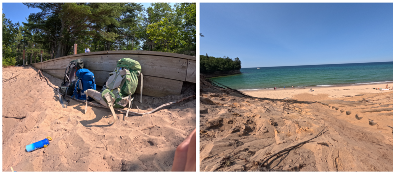
We got to the beach at about 3:30 in the afternoon. A more idyllic spot could not have been devised. The weather was absolutely perfect, and it had the kind of sand you just want to keep digging your toes into. There was a long wooden staircase down to the shore. Lionel and Brian decided to go dip their toes in Superior. I feared that if I took my shoes off, they would never come back on. Instead, I decided to go on a water hunt since the crew was down to about a quarter of our water supply.
From here, I imagined we had about another hour’s walk to the campsite. While searching for water, I had a punch to the gut when I saw the wooden sign read: Beaver Creek 5.1 miles. I had a mini moment of negative mental spiral. I knew the day would be tough. I like tough. But this was a bit past my comfort-tough zone. Plus, we didn’t have enough water unless we used the Platypus water purification system, which would take about 30 minutes. With three more hours of hiking, I wanted to get a move on. At that moment, I lost sight of the beauty of Chapel Beach as I trudged down the logs and through the sand to alert Brian to our predicament. He had a good old Brian chuckle and said, “Well, let’s do it.” Perhaps most surprising of all was Lionel, who seemed to have no problem with the idea of walking another five miles.
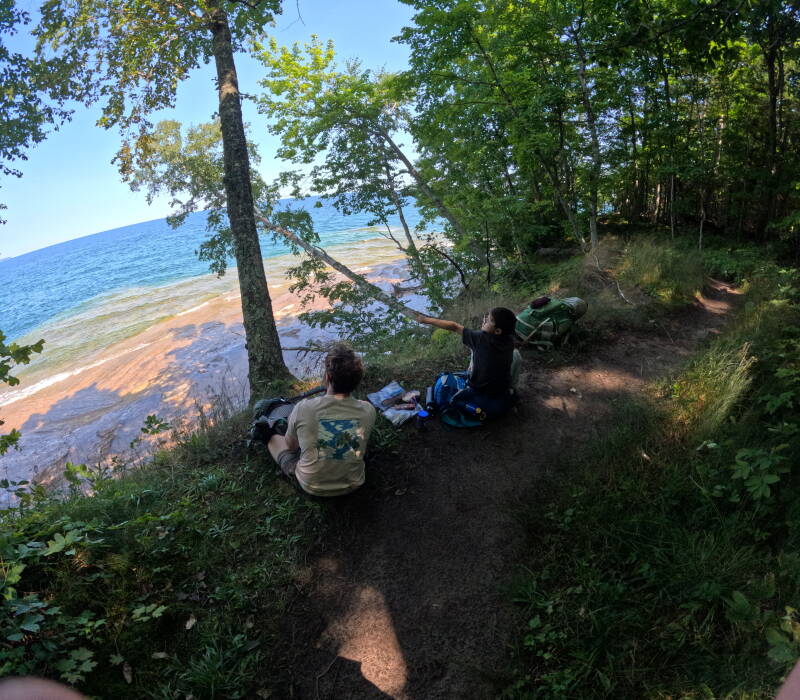
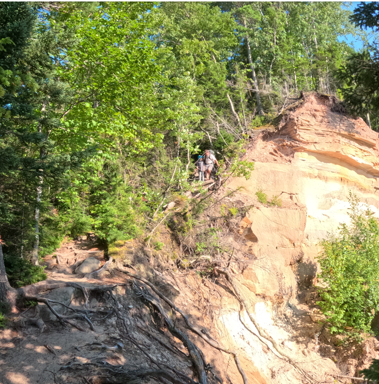
While I loved Lionel’s positive energy, I decided that after ten miles, it was time to give him a bit of a break. I decided to carry Brian and Lionel’s bags and shoot up the trail ahead of them. I could go a little faster and just focus on the rhythm of my steps. After 30 minutes, Brian and I could switch roles. Coming out of Chapel Beach, the path immediately became tricky, with a lot of rocky ups and downs. I decided to put the bags down and just assist Lionel in making sure he made it up and down safely before darting off again. I really prayed the path would even out soon, or else these five miles would get us to the campsite after sundown.
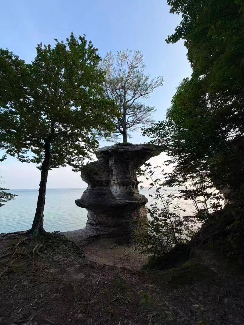
One thing about racing against time is that you sometimes lose sight of the whole reason you are in nature. I was finally getting a full head of steam when I saw probably the coolest landmark on the walk. I debated whether or not to put the bags down and dig out my camera or just keep walking. I finally reasoned with myself to stop for a picture of the boulder that had been hollowed out, with a tree growing on top of it. I even paused for a full minute to appreciate how long that landmark must have been there and the resilience of the tree. I then threw the bags back on and went full steam ahead for another 30 minutes, finding a nice section overlooking Superior where I could stop and wait.
About 15 minutes later, I heard Lionel gabbing about the different strengths of swords in Minecraft based upon which resources were used to make them. Brian is almost as good as my mother at coming up with questions. We took a little break and called Xiao Hong. One nice thing about this trip, compared to the Boundary Waters was that we had cell service. Lionel talked excitedly to his mother, mostly about the exciting information he had imparted on Brian about Minecraft, before I told him we had to hit the trail.
This time, Brian took the bags and ventured ahead. Lionel was quite disappointed, as I did not seem to have the same level of fervor for Minecraft as Brian did. I was getting far too concerned about our water situation. After another 60 minutes of painful, albeit gorgeous walking, I checked with Brian to see how much farther we had. We were dangerously low on water, which meant I couldn’t use the power fuel of Sour Patch Kids on Lionel. According to Brian’s app, we had just over a mile left.
I wanted to hurry ahead to fill up on water from Superior, so I cruised ahead with the backpacks. I was walking at a grueling pace, figuring I would be close, when I saw yet another ominous sign. After 20 minutes, it told us Beaver Creek would be in 1.7 miles. Some choice curse words ran through my head, but I continued to pace vigorously forward. About 20 minutes later, I saw a Beaver Creek sign saying 0.2 miles. I then walked for another 15 minutes at near the same speed and still hadn’t come upon the sign for the camp site.
I had to drop the bags and go scout ahead. At least I had popped out near the shore and could fill up the water. There was a big sandy bluff next to where I was that I thought might be the campsite. Before checking whether or not it was Beaver Creek, I made sure to fill our water. I then trudged up the sandy dune to see if it was the site. Thankfully, it was. Unthankfully, I would have to go back down and grab the bags and water to bring them back up.
As I hauled everything up, I saw Brian and Lionel already at the site. Apparently, there was a little back trail from the path that I had missed in my fitful walk. I sat for a bit feeling a little like Tweety Birds were floating around my head. I definitely, definitely needed to drink some water and kick off my hiking shoes. Brian whipped us up yet another scrumptious Jetboil meal, and after some food and drink, I was feeling back to myself.
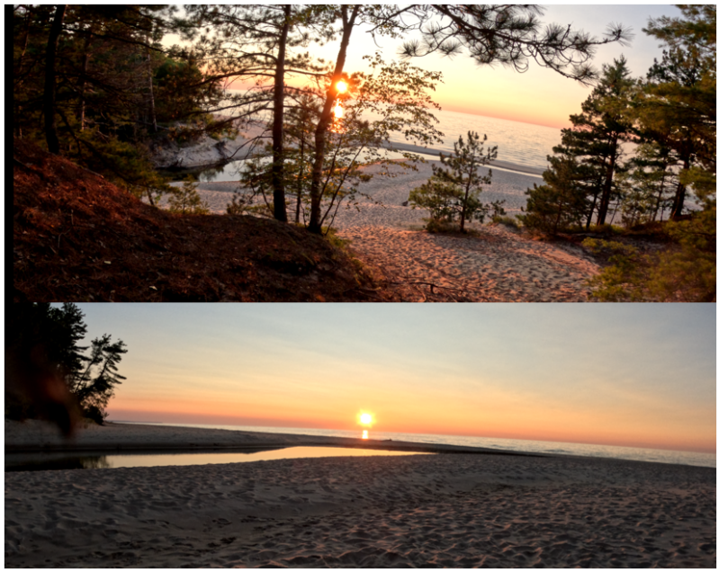
For me, it was one of the toughest tasks I had done for Hope in Motion, and likewise, it was for Brian. While Lionel was surely a bit tired, he didn’t express it. He had his mind set on going down to the beach area below to explore. Brian kindly brought him down while I cleaned up and stashed our items in the bear box. While I certainly never want to hike that distance again, I was thankful that we had a reservation at the Beaver Creek campsite. It was a phenomenally beautiful spot, with a view of a sunset that you’d need a 64-color box of crayons to fully capture.
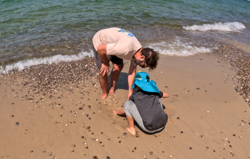
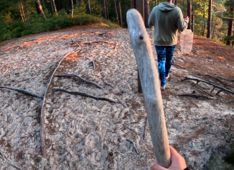
Down by the beach, Brian found a piece of driftwood that was the exact size and weight of a torch. Lionel brought it back with hopes of whittling it into a pickaxe or… a flyswatter. He made sure to carry it for the entire rest of the journey, and he still sleeps with it on his bedside table.
Fortunately, the following day would only be about a 1.4-mile walk. I was looking forward to a leisurely morning and, hopefully, a good night’s sleep.


Create Your Own Website With Webador